
- Employee
- 10/11/2026

Computer scientists design railway map for NS competition
The Dutch Railways (NS) asked participants to design a railway map featuring the numbers that train lines will be assigned next year. Researchers from TU/e’s Applied Geometric Algorithms group were quick to take up the challenge. They entered the competition, although they unfortunately did not win. Still, the project, which kept them busy for several weeks, turned out to be a fun team effort.
Taking part in a public competition during working hours is not something you see every day. Assistant professor Thomas van Dijk has good reasons for doing so.
“First, participating gives our research visibility among a wider audience. It shows that the results of the algorithms group’s research are also relevant to society. And it gives us scientific insights as well, because we are now using the things we design ourselves.” He explains that their research is usually tested by research participants.
After deciding to enter the competition during a coffee break, the colleagues spent the summer working together on a graphic design for the Dutch railway map. The new feature was that it included all the numbers the NS will assign to its train lines starting in 2027.
Approach
“We came up with a style on paper, I wrote a program to develop the layout, colleague Wouter Meulemans’ software designed the national borders, and together we turned it into a complete map.”
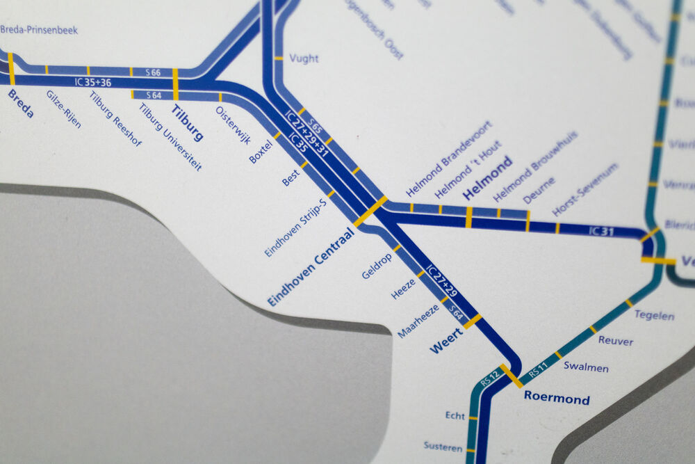
The first version of the map was displayed in the hallway on the seventh floor of MetaForum for a while, allowing passersby to share their feedback. “Some train users pointed out stations that were missing, which was very valuable to us. We incorporated all the feedback and made a few more improvements before submitting our entry.”
Proud of the result
Van Dijk does not consider the fact that the NS did not select their map as the winner a big deal. “Still, we would have liked to know why we didn’t win. The winning map looks remarkably similar to ours.”
The algorithms group was also proud to submit its map to Geo-informatie Nederland (Geo-Information Netherlands). This is a professional association for people who work with location-based data, for example at the Dutch Land Registry or Google Maps.
“The association holds an annual conference featuring a map competition called GeoBuzz. We haven’t attended before, but this year we will (November 16 and 17 in Den Bosch, ed.). That’s because we’re allowed to display our map there. We already know we won’t take first, second, or third place, but we do know that we’re among the top eight.”
This article was translated using AI-assisted tools and reviewed by an editor.
Discussion